
SITELINE GRID
Problem.
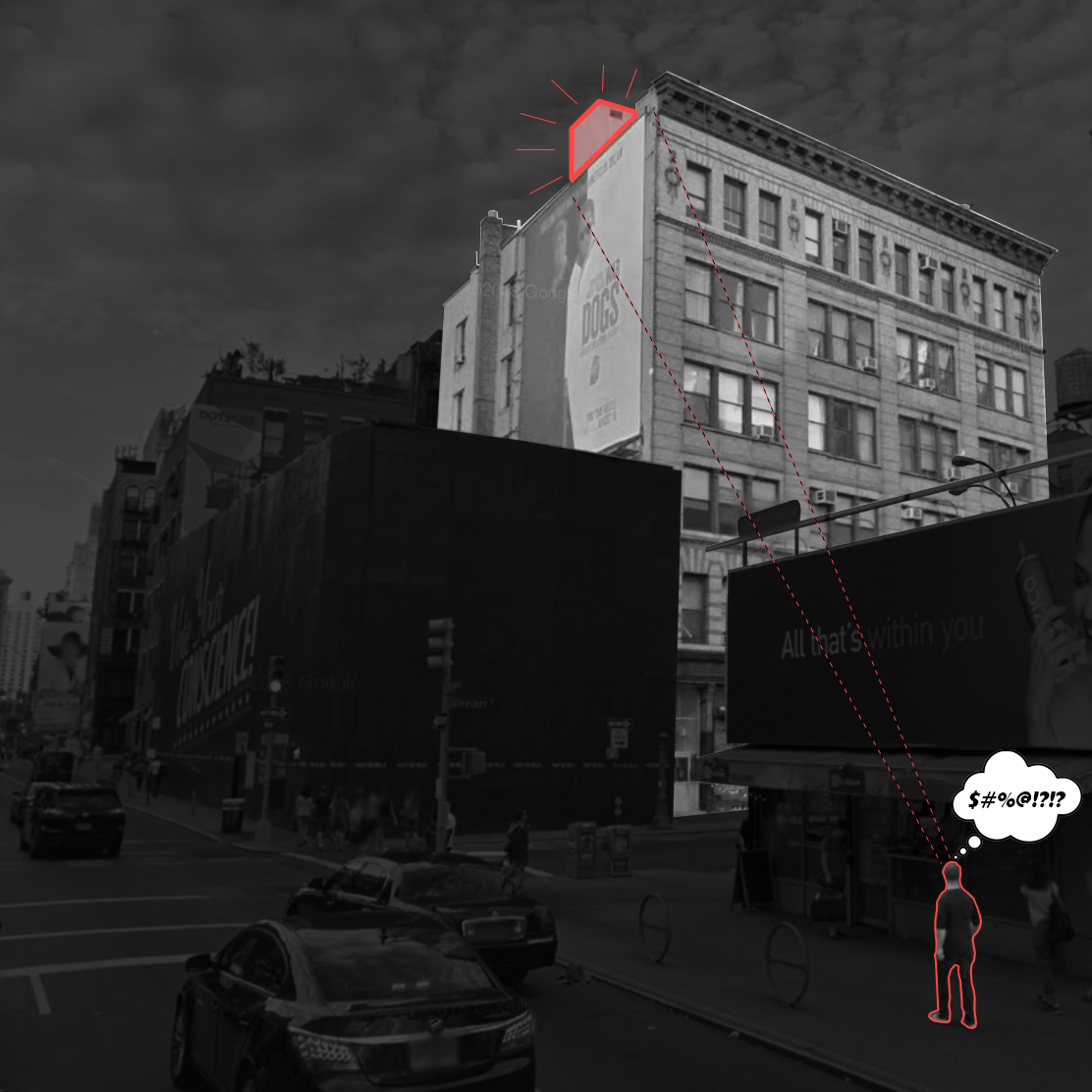
By adding bulkheads and/or rooftop amenity space to a landmarked building, the Landmarks and Preservation Committee wants to see the proposed masses from all vantage points pre-approval. This often requires multiple rendered views as well as temporary construction for LPC review. Even then, LPC may request even more rendered and sometimes heavily detailed views, which they can ultimately reject. This process creates a time and money issue for the project.
Solution!
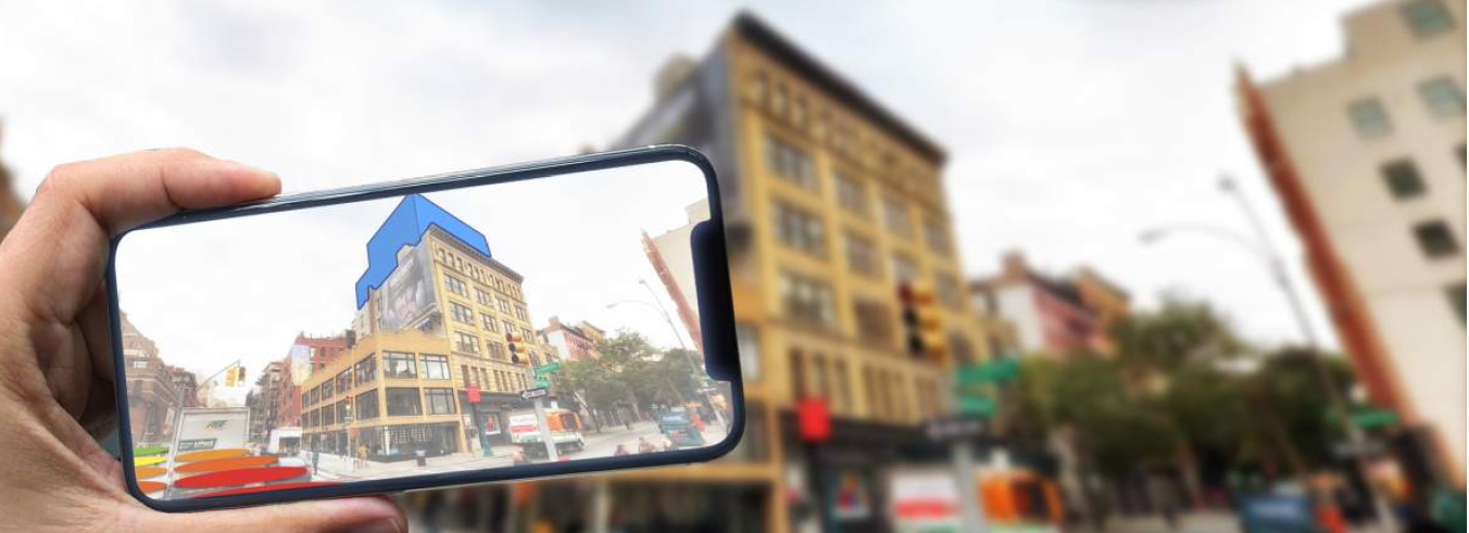
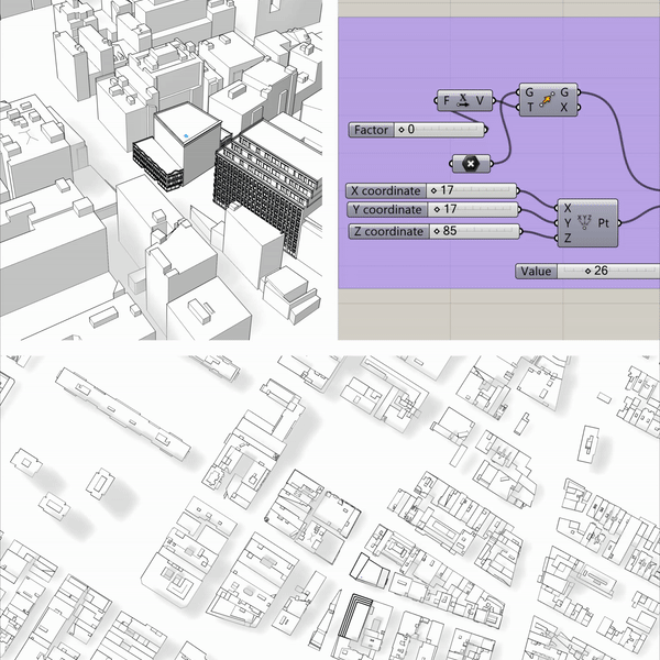
By utilizing Google’s 3D map of NYC folded into our architectural model, we can further understand the implications of our proposed additions as viewed from the street. Through modeling and parametric scripting, we can understand all of the locations at street level where our proposed addition will be visible from. As our design changes, the visible street locations update in real time. What we are left with is a map of all visible locations on the street, that can be embedded into both VR and AR applications for LPC’s use.
How it Works
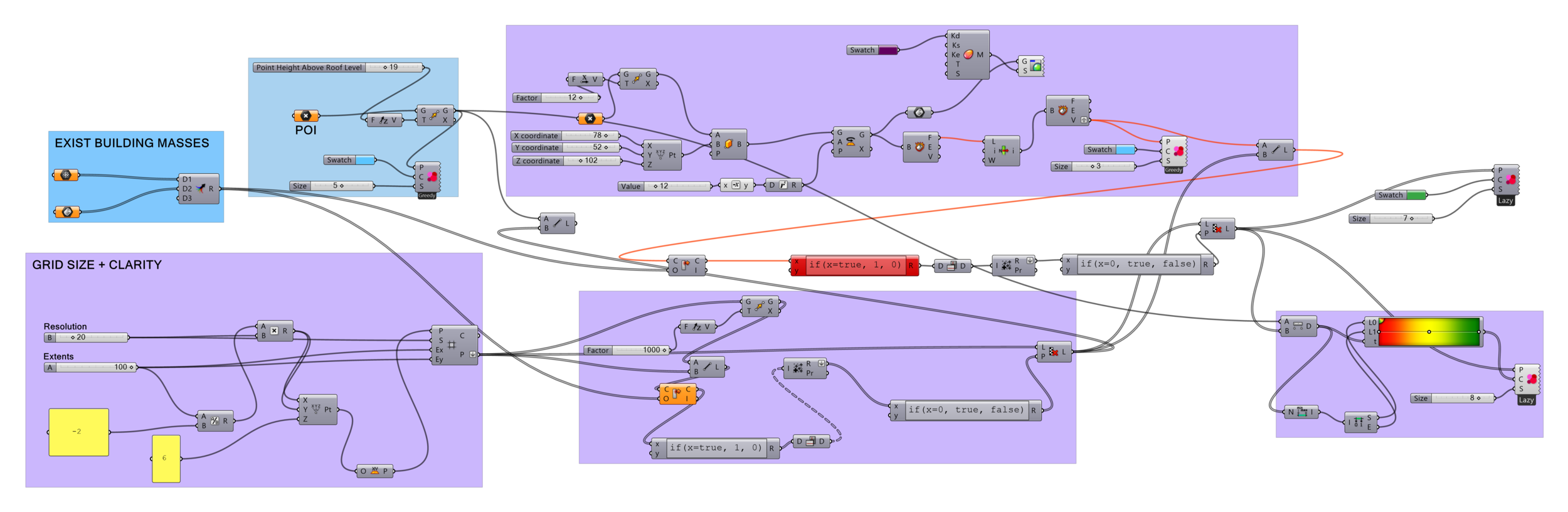
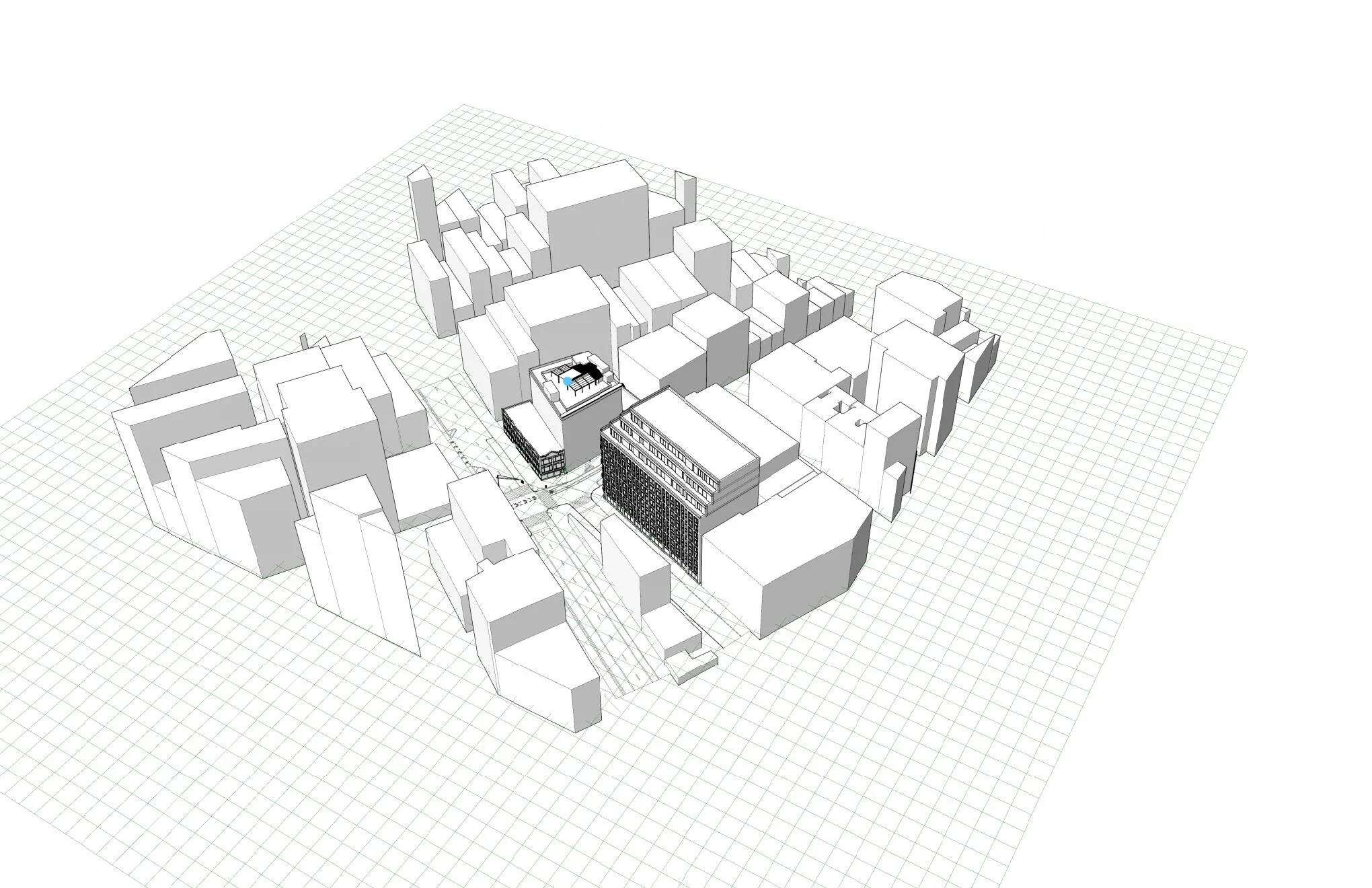
1 The grid at street level + focal point
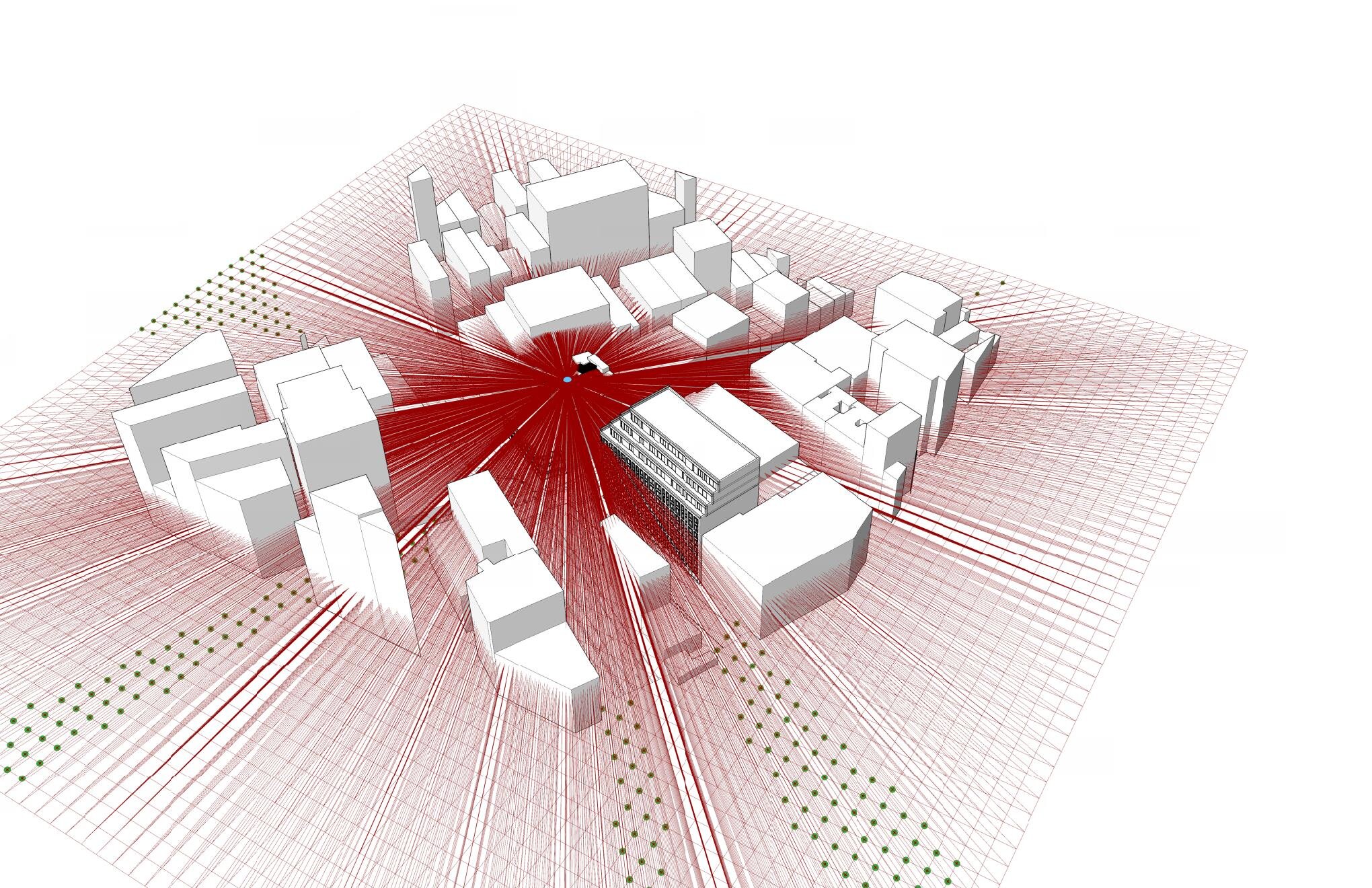
2 Grid-line intersections + view connectors to focal point
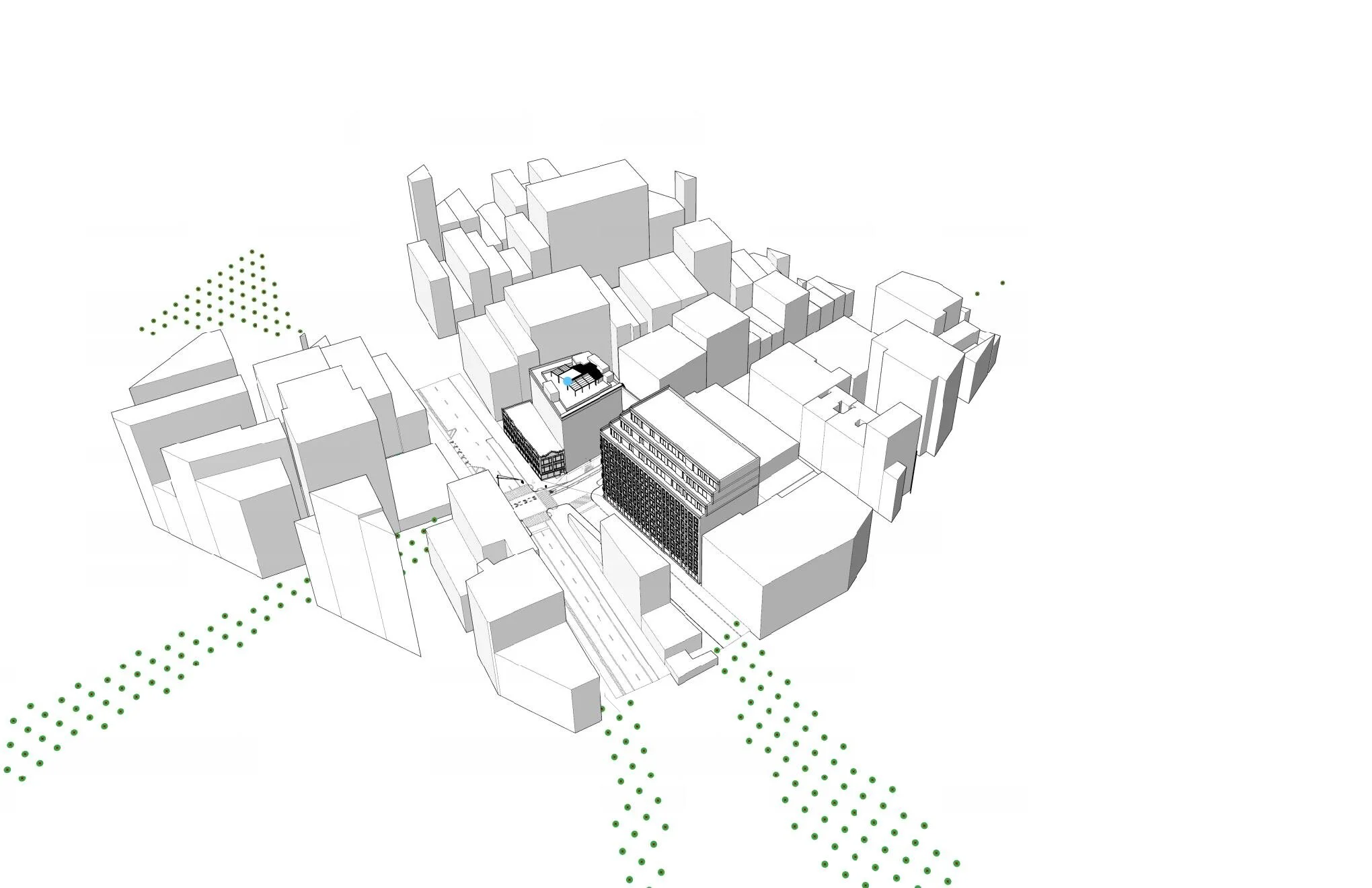
3 Locations at street level with unobstructed view of focal point
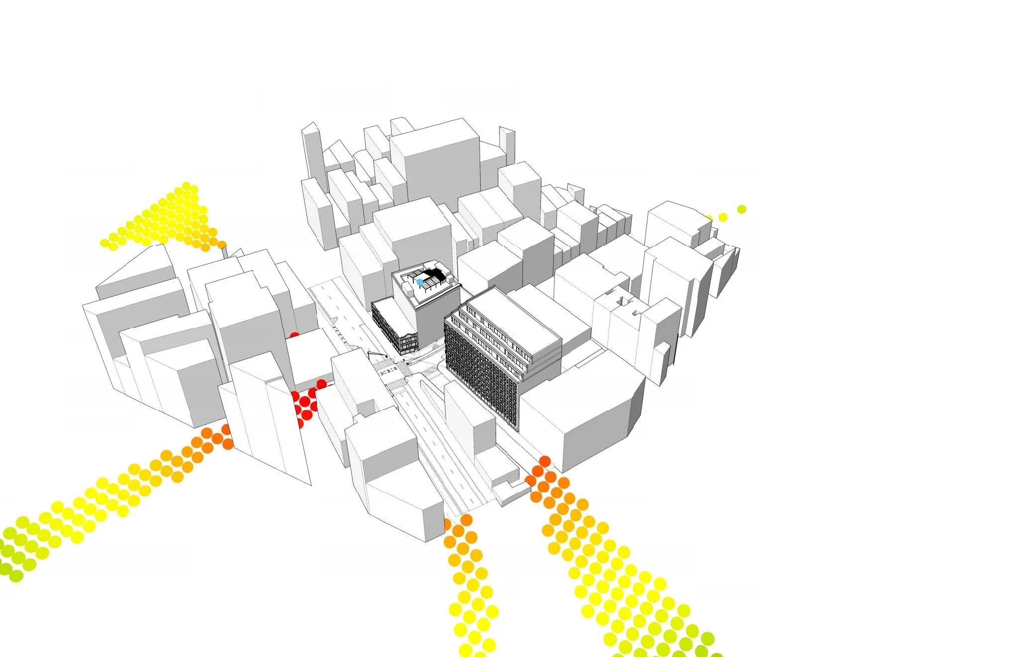
4 View Locations by distance from focal point